The situation
Identified as three separate sections of Roads of National Significance, the Northland Corridor connects Warkworth to Whangārei over approximately 100 km. The existing single carriageway faces safety and weather-resilience risks. A new dual carriageway is intended to unlock economic growth and productivity gains while improving resilience during extreme weather.
Technical approach
An extensive drilling campaign supported the ground investigation and feasibility studies. Most boreholes were logged with wireline geophysical tools to provide additional geological and engineering insight along the alignment. The predominant tools were:
- Mechanical 3-arm calliper
- Acoustic televiewer
- Optical televiewer
- Natural gamma
- Full waveform sonic
- P- and S-wave suspension logger
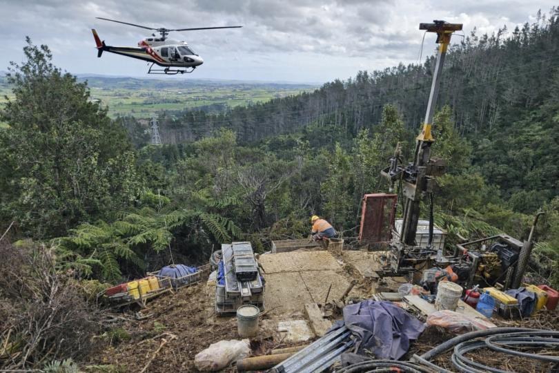
Data from each tool run was interpreted in conjunction with core information. Several boreholes were deep in New Zealand bush and difficult terrain, requiring helicopter-only access for drilling and wireline logging.
Outcomes
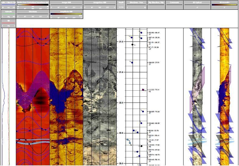
High-resolution acoustic and optical televiewer imagery identified key defect information, including highly fractured and seismically weak zones. These results sometimes differed from core observations, helping site geologists distinguish in-situ features from drilling-induced features and increasing confidence in their interpretations.
Natural gamma logging identified lithological changes through the profile and transitions between carbon-rich layers, such as clays and mudstones, and sand-rich layers, such as gravels and sandstones. This was particularly evident across changes between the Greywacke basement and the Northland Allochthon.
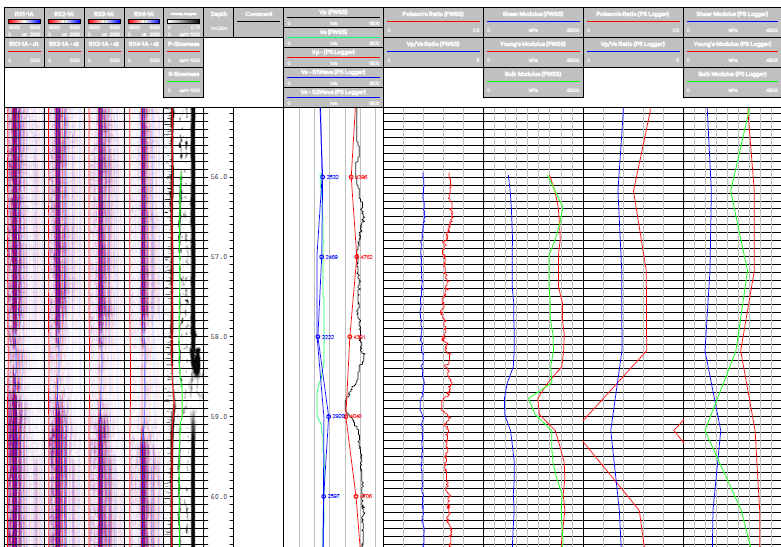
Through the Brynderwyn Hills, a proposed tunnel section required detailed engineering analysis. P- and S-wave velocities were collected at depth using full waveform sonic and P- and S-wave suspension logging. Both tools use an internal source and at least two sensors to calculate true-interval velocity at each depth. The methods therefore avoid the depth-related signal-to-noise losses and layer-interval interpretation issues commonly associated with surface and conventional downhole seismic testing.
Combining compressional and shear-wave velocities with laboratory density data enabled development of small-strain elastic-moduli profiles for:
- Poisson's ratio
- Shear modulus
- Bulk modulus
- Young's modulus
Summary
Using wireline geophysics alongside traditional geotechnical drilling added an extra layer of information to the investigation. Measurements could be compared along the alignment and fed directly into the geological model, further constraining it.
The seismic information provided greater resolution and accuracy than surface or conventional downhole seismic methods without the associated investigation-depth limitations; the practical limit was the depth of the borehole.
Technical contribution: GEOPHYSICS LTD