The situation
Wellington Water was assessing ageing wellfields that provide drinking water across Wellington. Geophysics Ltd was asked to undertake internal condition assessments on several water wells using a range of wireline geophysical techniques.
Technical approach
Geophysics Ltd deployed wireline tools typically used in the geotechnical and mining industries to provide depth-accurate, repeatable digital and physical measurements inside the wells. The suite included:
- Acoustic televiewer using a special very-large-bore ALT ABI tool
- Optical televiewer, including ultraviolet capability
- DGRT 360-degree downhole camera
- Fluid temperature and conductivity
- Mechanical calliper
- 500 m Mount Sopris wireline winch
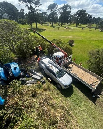
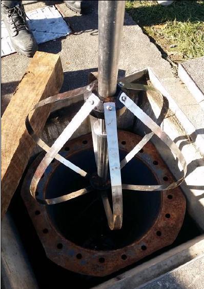
All pumps, stuffing boxes and top hats or casing lids were removed by crane. Once each well was clear, logging was undertaken using a sheave block suspended from the crane. Large specialised centralisers were fitted to keep the imagery tools centred in wells measuring 800-950 mm in diameter.
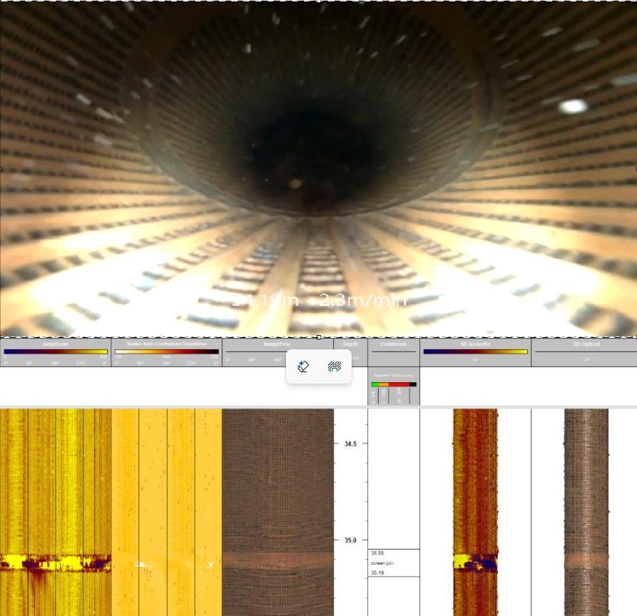
These techniques provided insight into fluid conductivity, screen quality, metal loss, casing thickness and verification of construction records. No approach short of physically removing and inspecting the casing would provide an equally accurate and comprehensive internal condition assessment.
Outcomes
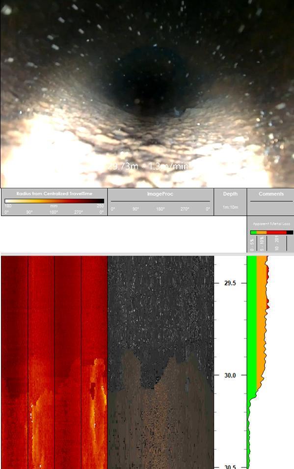
A comprehensive high-resolution dataset was collected with clear depth and casing-integrity information. Defects were identified with millimetre accuracy, predominantly using the 360-degree acoustic and optical televiewers at a typical vertical sample interval of 1-2 mm.
J-latches, casing joins and screen condition were assessed relative to age, and casing separations were highlighted. Calcific build-up was observed on the well wall. Acoustic calliper measurements quantified deposits up to 60 mm thick and identified areas requiring scrubbing.
Apparent metal loss was calculated from inside the well using acoustic calliper data. This information helped the client make informed decisions as wells approached the end of their operational lives.
Summary
Using wireline geophysical tools outside their usual environment can provide essential information for utility providers managing ageing assets. Compared with a standard camera survey, the combined methods produced much greater insight into well condition.
As population growth places greater pressure on water-resource infrastructure, extending well service life is increasingly important. Wireline geophysical surveying supports effective asset management and long-term water security by delivering critical condition and integrity information.
Technical contribution: GEOPHYSICS LTD